Grow Under the Open Sky
Outdoor Growing Guides
Predicting Frost on Cannabis: How to Know If Your Plants Will Ice Up Tonight
Predicting frost on cannabis: why your plants ice up when the forecast says 3°C. Dew point, black frost and frost pockets explained for growers.
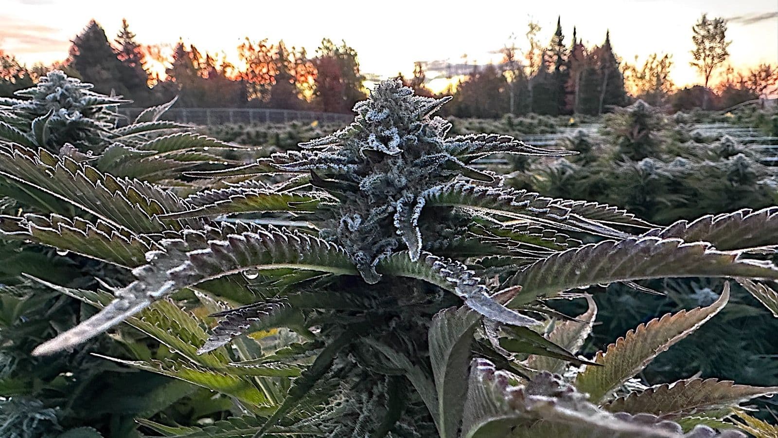
Frost often forms on cannabis plants while the forecast still reads 2 or 3°C. The weather station measures air about 1.5 metres up, in a shelter. On a clear, calm night the air at ground level can be up to about 5°C colder, and exposed leaves also drop below the air temperature. Three conditions predict frost: clear sky, calm wind and a low dew point.
Key takeaways
- To predict frost on cannabis, do not trust the forecast number alone: frost often forms while it still reads 2 or 3°C.
- On a clear, calm night, the air at ground level can be up to about 5°C colder than at station height.
- Three conditions predict frost: clear sky, calm wind, low dew point.
- In very dry air, plants can freeze with no visible frost. That is black frost, the more damaging kind.
- Cold air pools in low spots: in our experience, one property can vary by 3 or 4°C on the same night.
- Why does it frost when the forecast says 3°C?
- How do you predict frost on a cold night?
- Where does frost hit first in a garden?
- What temperature actually hurts cannabis?
- How do you predict frost on your own land?
- How do you prepare when frost is forecast?
- FAQ — Predicting frost on cannabis
The forecast was not wrong. The weather station measures air about 1.5 metres off the ground, inside a ventilated shelter, not the surface of your leaves. On a clear night the air at ground level can be up to about 5°C colder than at station height.
We have been through it: in mid-October 2024, our colas were coated in heavy frost at sunrise, and some plants were still frozen five days later. Understanding that gap is what lets you cover your plants in time.
Why does it frost when the forecast says 3°C?
Because the forecast measures air, not your leaves. On a clear, calm night, foliage loses heat to the sky by radiation and ends up colder than the air around it. According to the US National Weather Service, air at ground level can be up to about 5°C colder than at station height.
During the day, soil and plants absorb solar heat. At night they release it skyward as infrared radiation. When clouds are present, they bounce part of that heat back down. When the sky is clear, nothing holds it.
The result: exposed surfaces such as leaves, grass and car roofs end up colder than the air. That is why you find frost on the windshield while the official thermometer never dipped below freezing.
The role of dew point
Dew point is the temperature at which moisture in the air condenses (National Weather Service). Three scenarios:
- Dew point above freezing: moisture settles as liquid dew
- Dew point below freezing: it deposits directly as ice crystals, which is white frost
- Very dry air: nothing deposits, nothing slows the cooling, and the foliage freezes with no visible ice, which is black frost
How do you predict frost on a cold night?
Three conditions together make frost likely: a clear sky, calm wind and a low dew point. One more clue is a temperature that falls quickly in the early evening. When all three line up and the forecast low is under 4°C, get your covers ready before dark.
1. Clear sky. No clouds to trap heat, so radiational cooling runs at full strength.
2. Calm wind. A light breeze protects, because it mixes the air and keeps the cold layer from settling at ground level. Orchards run frost fans for exactly this reason. Without wind, cold air settles in.
3. Low dew point, near or below freezing. The lower it is, the less moisture slows the temperature drop.
The practical rule: clear sky + calm wind + low dew point + forecast low under 4°C = expect frost on the foliage.
Where does frost hit first in a garden?
In the low spots. Cold air is denser than warm air: it runs downhill, pools in hollows and stalls behind obstacles such as a dense hedge, a low wall or an embankment. Those areas become frost pockets: in our experience, sometimes 3 or 4°C colder than a spot a few metres away.
What temperature actually hurts cannabis?
Damage depends on the temperature of the foliage, not the forecast. By our field benchmarks, on whole plants in the field: from 0 to -2°C, a light frost and marked foliage; from -2 to -4°C, visible damage; below -4°C, serious damage.
A Cornell University study adds a lab benchmark: CBD hemp leaves, detached and held for 3 hours in a freezer at -2, -4 and -8°C, took clearly more damage at -8°C than at -2 and -4°C. The authors conclude that hemp may be quite tolerant to short periods of frost before harvest (Galic et al., Horticulturae, 2022).
What happens inside the plant
Under natural conditions, ice forms first in the spaces between the cells, where the fluid holds fewer sugars and freezes sooner. Ice inside the cells themselves mostly happens with very rapid cooling.
Those crystals draw water out of the cells. That dehydration, described by Pearce in the Annals of Botany, is what finally breaks the membranes. The cell contents leak and oxidize, which is the blackening you see the next day.
Do not count on plant age to protect it: the Cornell study found no advantage in older plants.
How do you predict frost on your own land?
Measure where your plants grow, not at the station. A min-max thermometer set at cola height gives you the real overnight low. After two or three cold nights you will know the gap between your ground and the forecast, and the forecast number at which your covers need to go on.
- Min-max thermometer at cola height, in the lowest corner of your plot
- Frost log: write down the forecast low, your measured low, the sky and the wind
- Morning check: note where frost shows up first; that is your map of frost pockets
How do you prepare when frost is forecast?
As soon as frost is forecast: water the soil one to two days ahead, rake mulch back, bring pots in and get your covers ready. That evening, if the sky is clear and the wind calm, cover before dusk. Every step is in our guide to protecting plants through a freezing night.
If your plants are close to ready, read how far to push a late harvest up north before deciding whether to protect or cut, and, when the time comes, why we harvest at night.
To plan your whole season, our month-by-month outdoor calendar maps the critical windows by region.
And if a damp autumn worries you as much as the cold, the fungal disease guide covers botrytis, which thrives on the same cool, wet nights.
For a season that wraps up before the hard frosts, our autoflowering strains finish in 70 to just over 100 days from seed, depending on the strain.
Where do these numbers come from?
Radiational cooling and the role of dew point are documented by the National Weather Service, and the gap between ground-level and station-height air by its La Crosse office, which also published the frost thresholds quoted above. The difference between white and black frost, and between radiation and advection frost, comes from the FAO, as does the importance of site selection (FAO, chapter 6). Ice forming between the cells is described by Pearce (2001), Annals of Botany. Average first-frost dates in Quebec come from MétéoMédia. The hemp frost test comes from Galic et al. (2022). The damage thresholds on whole plants are our field benchmarks.
FAQ
Can you get frost at 2 or 4 degrees Celsius?
Yes, on a clear, calm night. Near the ground the air can be up to about 5°C colder than at station height. A National Weather Service La Crosse office study found patchy frost with lows of about 3 to 6°C, areas of frost at 1 to 3°C, and widespread frost at 0°C and below. At 4°C, expect it only in low spots.
Will it frost tonight?
Check three conditions together: a clear sky, wind under 5 km/h and a low dew point. One more clue is a temperature that falls fast in the early evening. When all three line up and the forecast low is 2 to 4°C, expect frost on the foliage and get your covers on before dark.
When is the first frost date in my area?
Look up your local average first fall frost date in provincial or federal climate data. In Quebec, averages run from around September 17 to 19 in Val-d'Or, Sept-Îles and Gaspé to October 5 in Quebec City and October 17 in Montreal, according to MétéoMédia. It is an average, and the low spots on your land frost first.
What temperature does frost form on plants?
Often while the weather station still reads 2 or 3°C. On a clear, calm night the air at ground level can be up to about 5°C colder than in the shelter, and exposed leaves reach 0°C before the station does.
Does wind prevent frost?
Light wind helps. It mixes the air and keeps the cold layer from settling at ground level, which narrows the gap between leaf and air temperature. A breezy night at 1°C is often less dangerous than a dead-calm night at 3°C. Strong, cold wind is a different problem: it brings a whole cold air mass that covers can only partly block.
Does cloud cover prevent frost?
It usually does. Clouds act like a lid, sending part of the heat the plants radiate back to the ground, so on an overcast night the foliage stays close to the air temperature. That is why a sky clearing in the evening is a warning sign, even when the forecast low has not changed.
What is the dew point and why does it matter for frost?
It is the temperature at which moisture in the air condenses. When the air reaches it, dew or frost forms and releases heat, which slows the cooling. A dew point below freezing means moisture deposits as frost. In very dry air nothing slows the drop, and plants can freeze with no visible ice at all.
What is black frost?
Black frost is a freeze below 0°C with no visible ice. The air is so dry that no frost deposits, so nothing warns you and nothing slows the temperature drop. The foliage freezes and blackens the next day. According to the FAO, black frost does more damage than white frost, because depositing frost releases heat.
Why do plants at the bottom of my yard frost first?
Cold air is denser and flows downhill like water. It pools in hollows, valley bottoms and behind obstacles, which growers call a frost pocket. In our experience, the same property can see a 3 or 4°C difference between its high point and its low point on the same night. Plant on slopes and rises when you can.
What time of night is coldest?
Just before sunrise, not midnight. Temperature keeps falling as long as the surface loses more heat than it gains, so the low usually lands around sunrise, close to 7 a.m. in mid-October in Quebec. That is why a cover put on in the late afternoon has to stay until morning, and why frost shows up when you wake.
What is the difference between radiation frost and advection frost?
Radiation frost is the one growers can beat: a clear sky, little wind and a layer of cold air settling at ground level while warmer air sits above it; the air in the weather shelter can itself drop below 0°C. Covers and moist soil work well against it. Advection frost brings arctic air and wind; the whole air column is below freezing, and covers help far less.
19+ | Educational horticulture only.